


Zoning 2.0: Not Just An Upgrade
A Whole New Way of Looking at Land Use
When you bring up zoning in conversation, you’re likely to encounter a sea of blank stares, unless you’re chatting with someone well-versed in urban planning. In that case, you will inevitably be met with a look of annoyance, irritation, or frustration. Zoning just has that effect on people. Yet, it’s a fundamental tool that shapes the very fabric of our cities, dictating what you can and cannot do with your property. From lot sizes to building shapes and permitted land uses, the zoning code governs it all. But this code, written in dense legalese, proves daunting to decipher for those lacking legal expertise or years of zoning experience. This complexity also puts off needed updates due to the hassle (and possibly fear factor) of taking a complicated legal document and changing it.
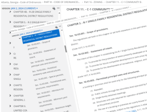 Which is why it is such big news that the City of Atlanta is doing just that. Most of our zoning code dates to the 1980’s. Over the past few years, the city conducted extensive research and held public hearings to craft an update that reflects our current aspirations for urban development, all presented in a much more user-friendly format. Enter Zoning 2.0, Atlanta’s latest zoning code draft.
Gone are the pages of legal jargon. Instead, we now have much easier to read tables, visual diagrams, and consistent language (and definitions) citywide. This new code is referred to in the planning world as “Form Based” and it helps to peek under the hood to see what that means.
Dive into the details, and you’ll find more diagrams and uniformly labeled tables, making it simple to understand property requirements, building sizes, and setback regulations. Take, for example, the new RH1 code which replaces the R-1 designation. Parcel size, setbacks, building envelope and lot coverage are clearly shown in both graphic and tabular form. Each designation is treated similarly, allowing easier comparisons between zones. The full form-based code can be found here.
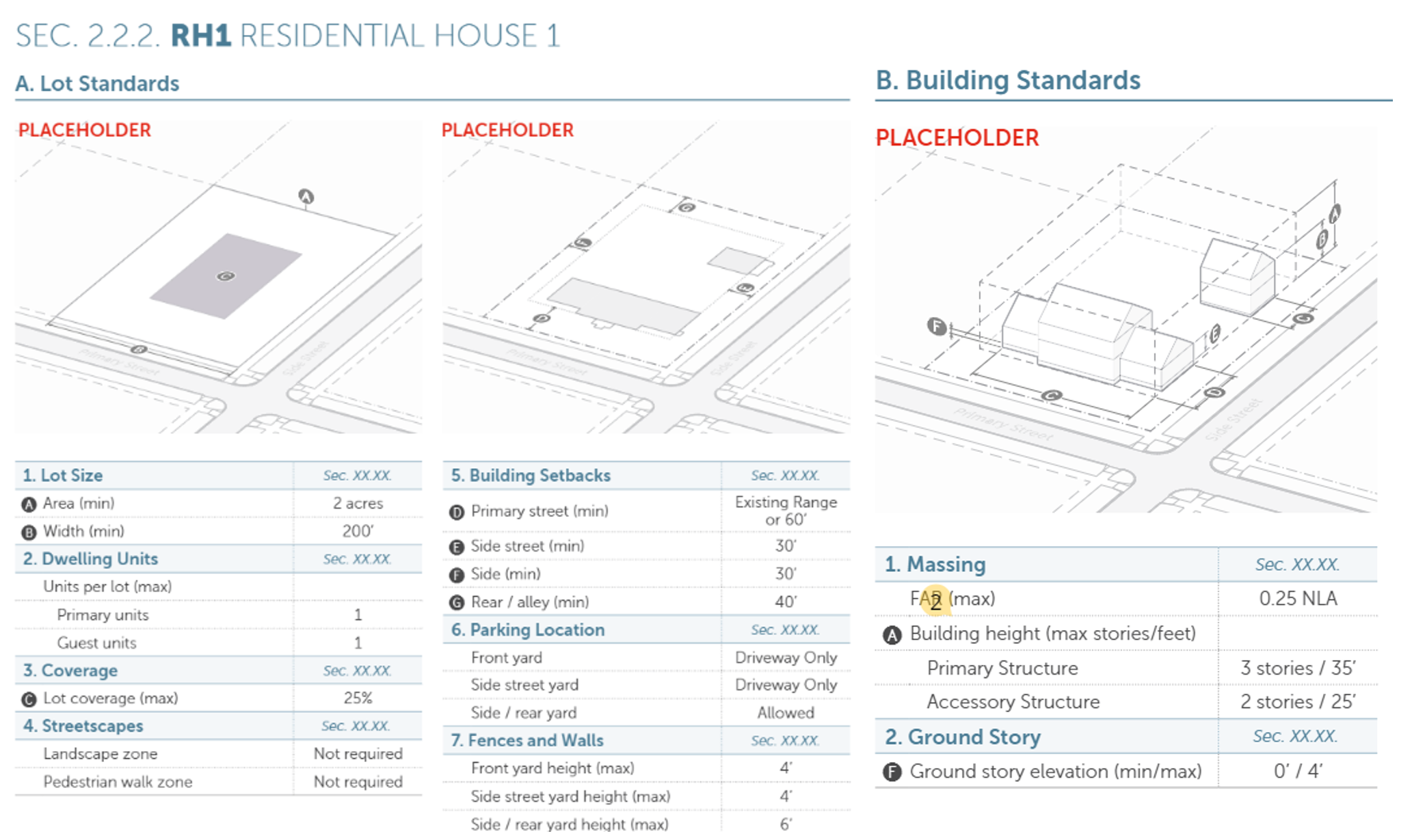
Click image to enlarge
Atlanta also modified the use table which is the exhaustive list of all the different ways buildings and land (e.g. single-family homes, coffee shops, self-storage facilities, gas stations, parks and so on) can be used. Unlike our current code, the definitions in the new use tables are standardized city-wide. Click here to view the land use table itself and here to review the definitions and explanatory text.
One phase of a Multi-part Process
Atlanta’s Zoning 2.0 draft release is just that—a draft. And only a partial draft at that. Still missing from the draft (and due in September of 2024) are other key parts of any zoning code:
Development Bonuses • Blocks and Connectivity • Streets and Streetscapes • Multi-Modal Access and Parking • Vehicle Access and Parking • Transitions and Screening • Fences and Walls • Landscape Standards • Signs • Outdoor Lighting
In December 2024, the city will release the final parts of the code that discuss the permitting and approval process, non-conforming land uses and code enforcement. Adoption is expected sometime in 2025.
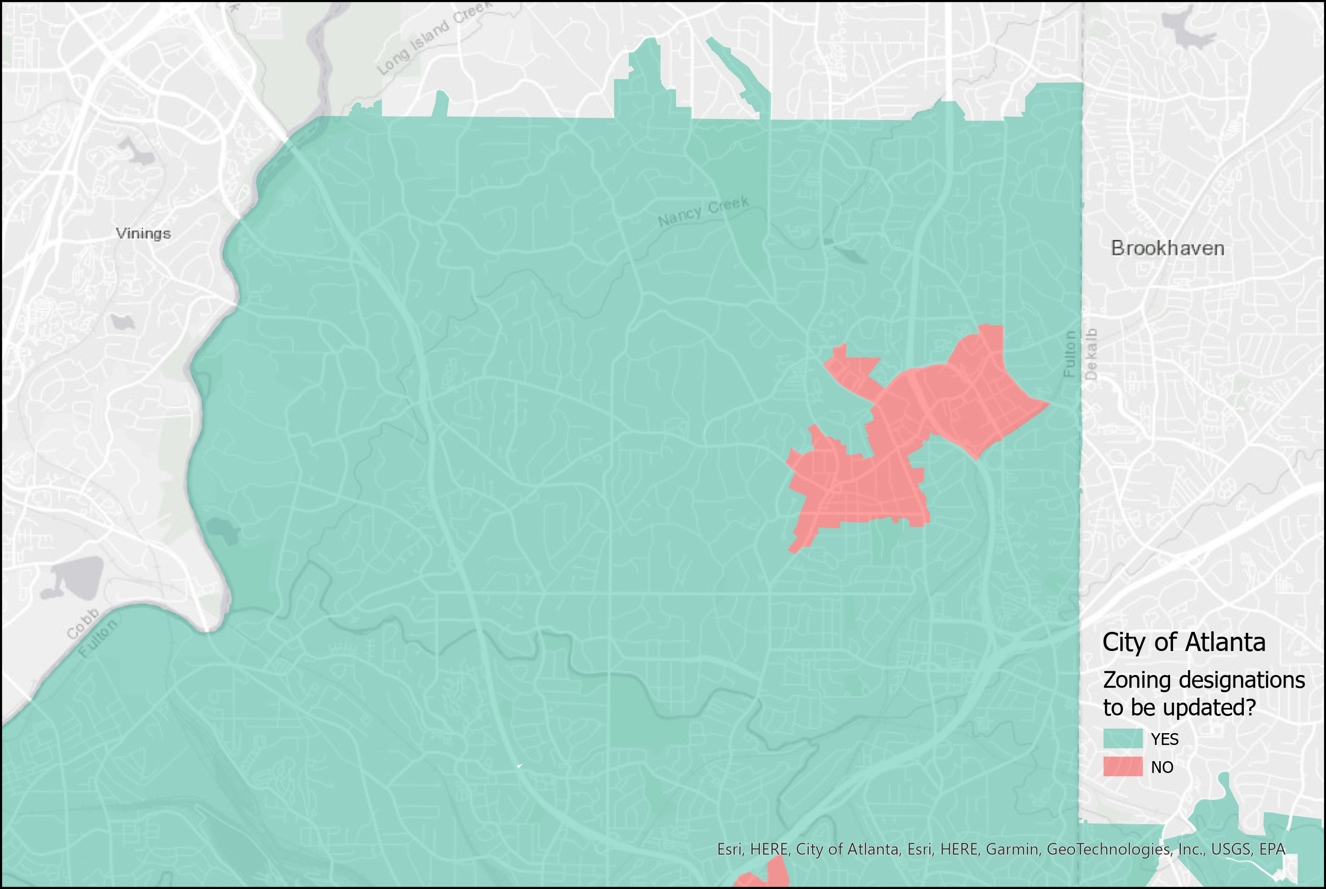
Click image to enlarge
It is important to note – some areas like SPI-9 and SPI-12 in Buckhead’s commercial core are NOT included in this process. Changes to these SPI’s and other areas like them in the city will be made as part of a separate planning process at a future date. Additionally, while many areas are receiving new zoning codes, care has been taken to match the new designation characteristics to those in the existing code with only incremental changes in what is allowed, and changes are made on a 1:1 basis with no properties being rezoned as part of this process.
Finally, it is important to note that Zoning 2.0 is operating in parallel with the city’s Comprehensive General Plan update. That document, which also is due out, will help shape the areas where the city grows and changes in and the areas where it preserves and improves what is already there. This document has a more aspirational look to it and a 20–30-year frame in mind. More information about the Comprehensive Plan update is available here.
So what does that mean to me? And our community?
Change, undoubtedly, but change for the better. Zoning codes are becoming more comprehensible, incorporating design criteria advocated by developers, neighborhood advocates, architects, and property owners. Livable Buckhead will be involved in this effort and in the coming months highlight how the codes will impact the greater Buckhead area and its constituent neighborhoods. In the meantime, we encourage you to check out the Zoning 2.0 page for yourself. Make comments and suggestions directly to the city. The documents are available in an easy-to-use format for commenting.
We also want to hear from you what you think and what Livable Buckhead should focus on during this process.


